


Wayne National Forest:
Bailey Run Trails
|
|
| |
Wayne National Forest: |
|
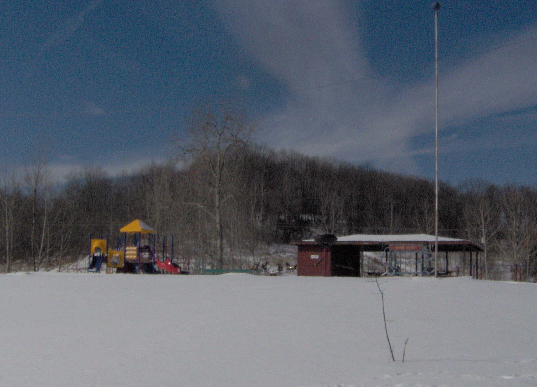 |
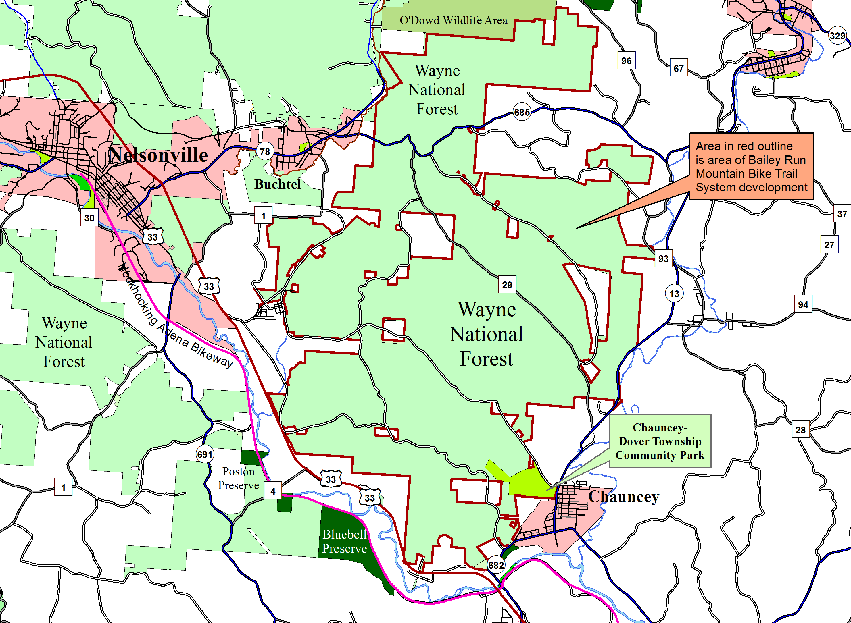
Semi-official siteThe Wayne National Forest does not yet show this trail system on its official website. The Bailey Run Trail system is a system of mountain-biking trails being developed in the Wayne National Forest. As of February 2020, there are 14 miles of loop trail built, with a trailhead in Chauncey, Ohio, is planned. Eventually the trail system is projected to include as many as 92 miles of trail. The system will be in the area bounded by Ohio State Route 685 on the north (with several miles of trail on the north side of 685), Ohio State Route 13 on the east, US Route 33 on the south, and Ohio State Route 78 on the west. There are plans for this trail system to be connected to the Hockhocking Adena Bikeway in Chauncey. A spur is being developed from the bikeway on River Road where the Norfolk-Southern Railway tracks cross the Hocking River, to Chauncey and up to Chauncey-Dover Township Community Park. The park will be the first of three planned principal trailheads, and will have a new entrance off West Bailey Road, Township Road 293, to be built as part of the development (access is now from the railroad tracks service road). The photograph to the left is of the park. Other planned trailheads will be developed near Buchtel and between Buchtel and Doanville. |
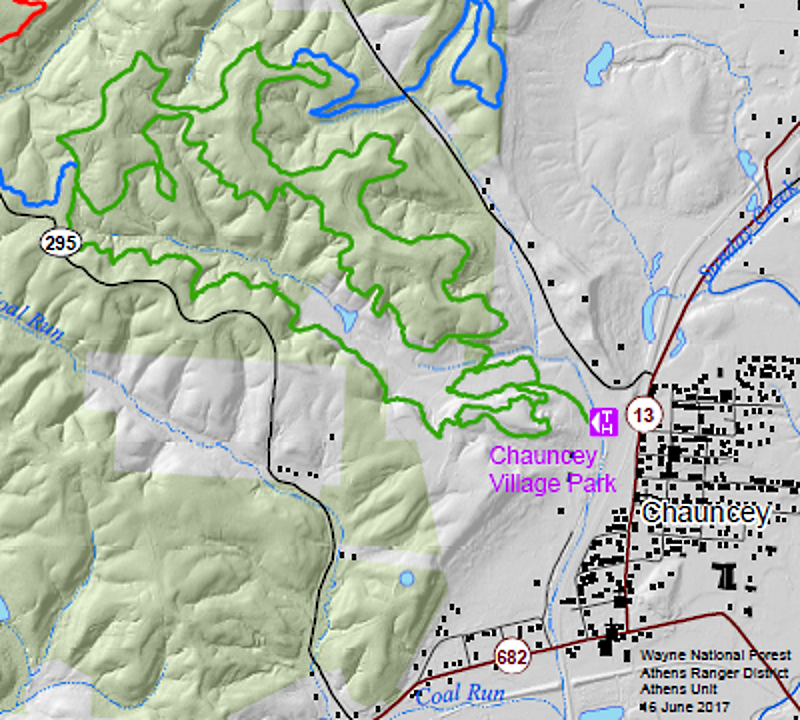
|
This project is a partnership between the Wayne National Forest, the Athens Bicycle Club, and other agencies. There had been talk of a mountain-bike trail system on the Athens Unit of the Wayne for years, but the real project wasn't initiated until a meeting in January of 2016, involving the WNF, ABC, Ohio University, and representatives from regional and national mountain-biking organizations. The Baileys Mountain Bike Working Group was established, led by the Athens Bicycle Club, but also including the Wayne, local planners, and the Athens County Convention and Visitors Bureau. A plan grew out of their monthly meetings, and maps were produced. A financing scheme involving private interests was floated, and the whole thing is now under process. To the right, in green, is the initial 14-mile loop to be built from Chauncey (portion of planning map from the Wayne). Directions to Chauncey Trailhead: The trailhead is in the Chauncey-Dover Township Community Park. From the intersection of Ohio State Route 550 with US Route 33 northwest of Athens (on Columbus Road), go northeast on OH-550 0.1 mile to Ohio State Route 13. Turn left on OH-13 and go 3.1 miles to the heart of Chauncey, where OH-13 turns right at the Marathon gas station. Turn right and go 0.6 mile to West Bailey Road, Township Road 293. Turn left on West Bailey and cross the railroad tracks. Immediately after crossing the tracks, turn left on the railroad service road (gravel) and to one long block to take the gravel service road into the park on the right. |
 |
The projected entire-system map from the Wayne: 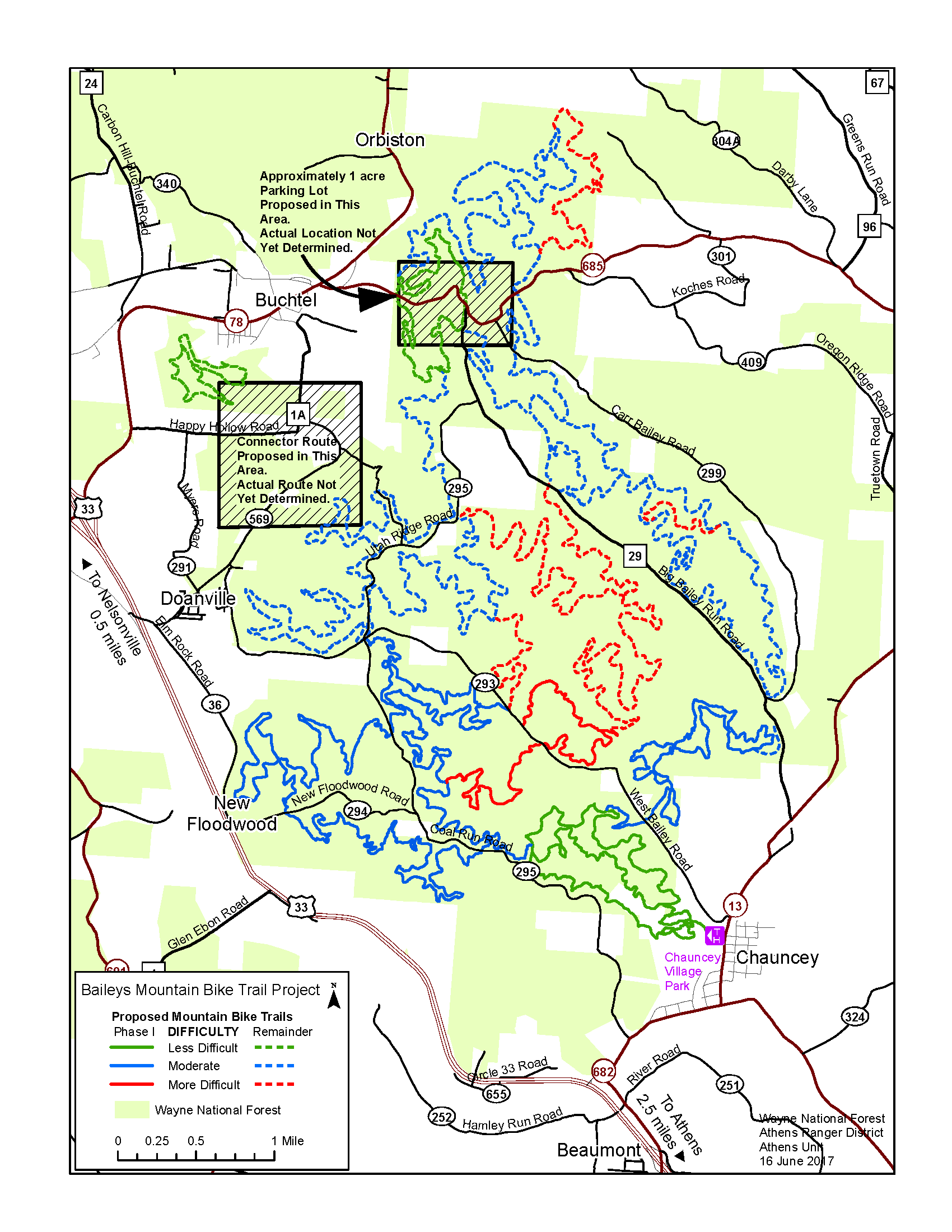 | |