


|
|
| |
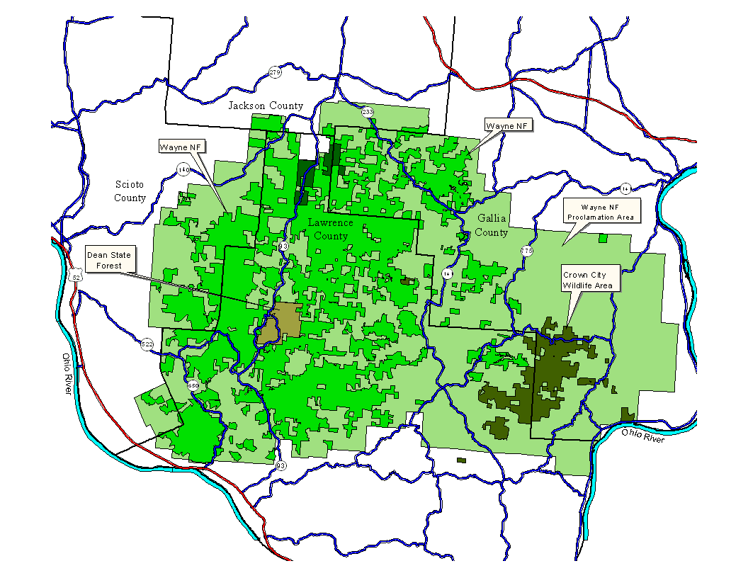
Wayne National Forest - Ironton District | |
|
The Wayne is Ohio's only national forest. It is located exclusively within the area of the unglaciated Allegheny Plateau, in southeastern Ohio. It is organized into three purchase units. The Ironton District is located mostly in Lawrence County, with lesser areas in Gallia, Scioto and Jackson Counties. The Ironton District, with 30,000 acres, features the most consolidated areas of the Wayne. The Wayne was established, as were many of the eastern US national forests, to buy up marginal, worn out farmland and other "worthless" lands to restore them to forest and thus productive use. Most maps show only the purchase units designated by Congress, but these, in the case of eastern states, generally include large amounts of private land. These mapped areas only show the area in which the National Forest Service is allowed to purchase land. This page shows both the purchase areas in light green and the actual land ownership in medium green. Other public lands in shades of green to brown are also shown.
|
 |