

Coalton
Wildlife Area

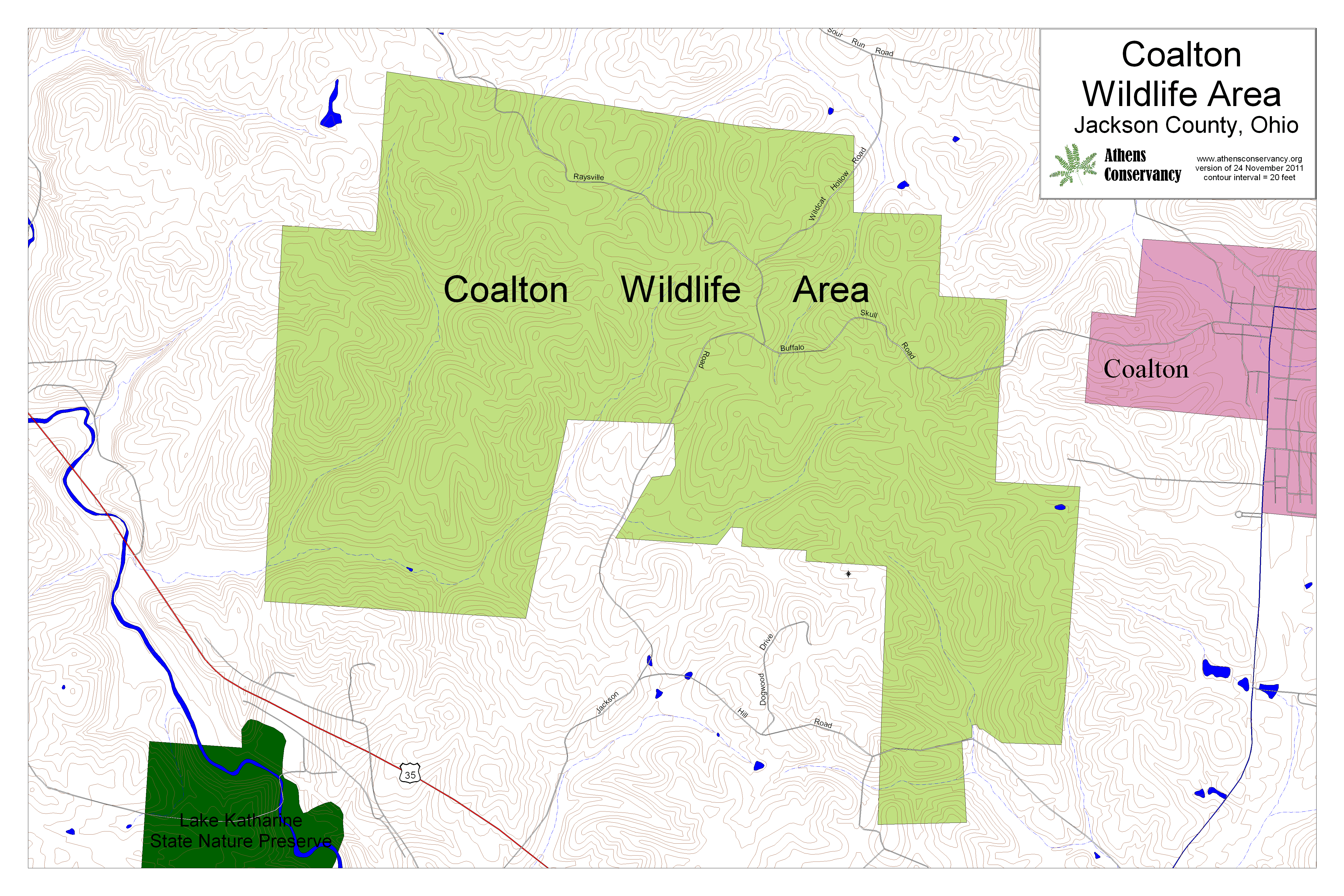
| Coalton Wildlife Area at a Glance | |
| Date established: | 2007 |
| GPS coordinates, intersection of Raysville Road and Buffalo Skull Road: | 39.112097, -82.638388 |
| Acreage (total): | about 1,729 acres (700 hectares) |
| Trails: | No trails |
| Hunting: | All hunting allowed |
| Nearby natural areas: | Hammertown Lake (City of Jackson) Leo Petroglyphs State Memorial Lake Katharine State Nature Preserve Liberty Wildlife Area Richland Furnace State Forest Lake Alma State Park Wellston Wildlife Area Superior Wildlife Area Vinton Furnace Wildlife Area |
| Official website: | http://wildlife.ohiodnr.gov/coalton |
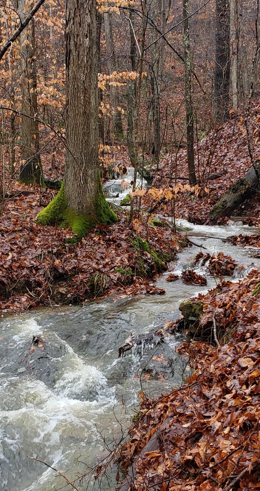 |
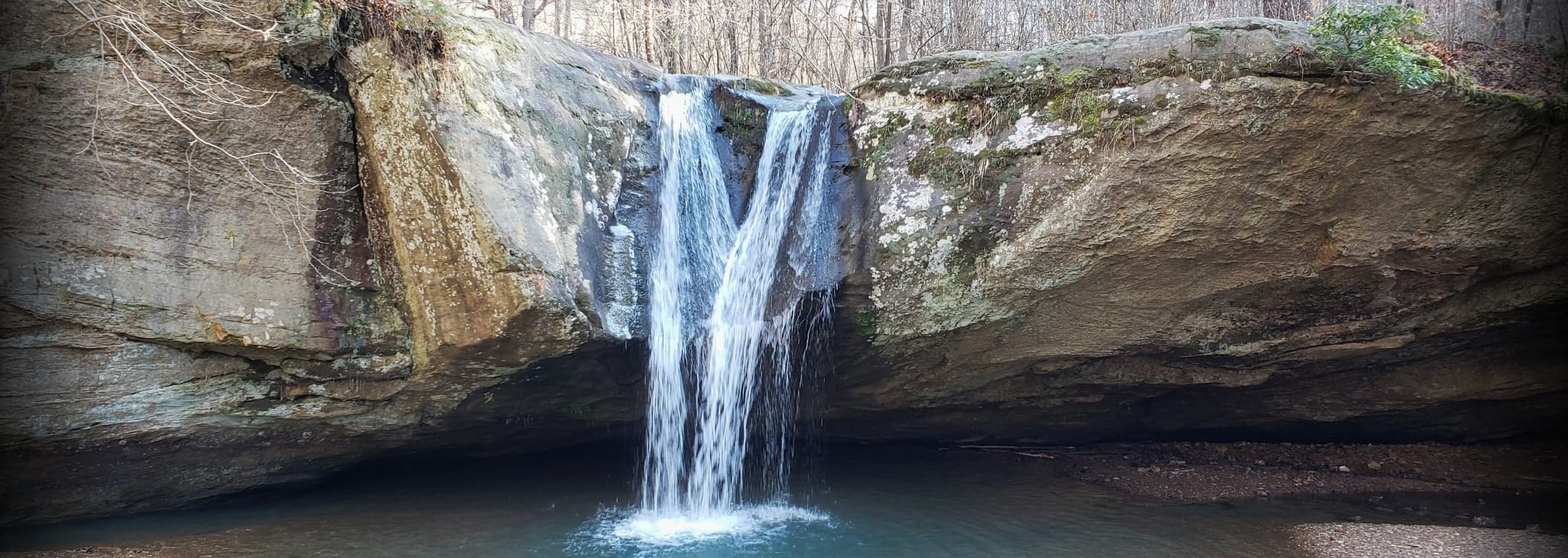
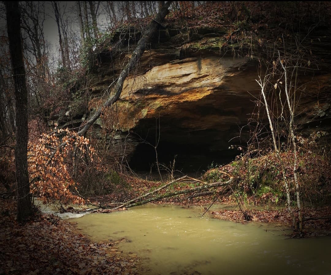
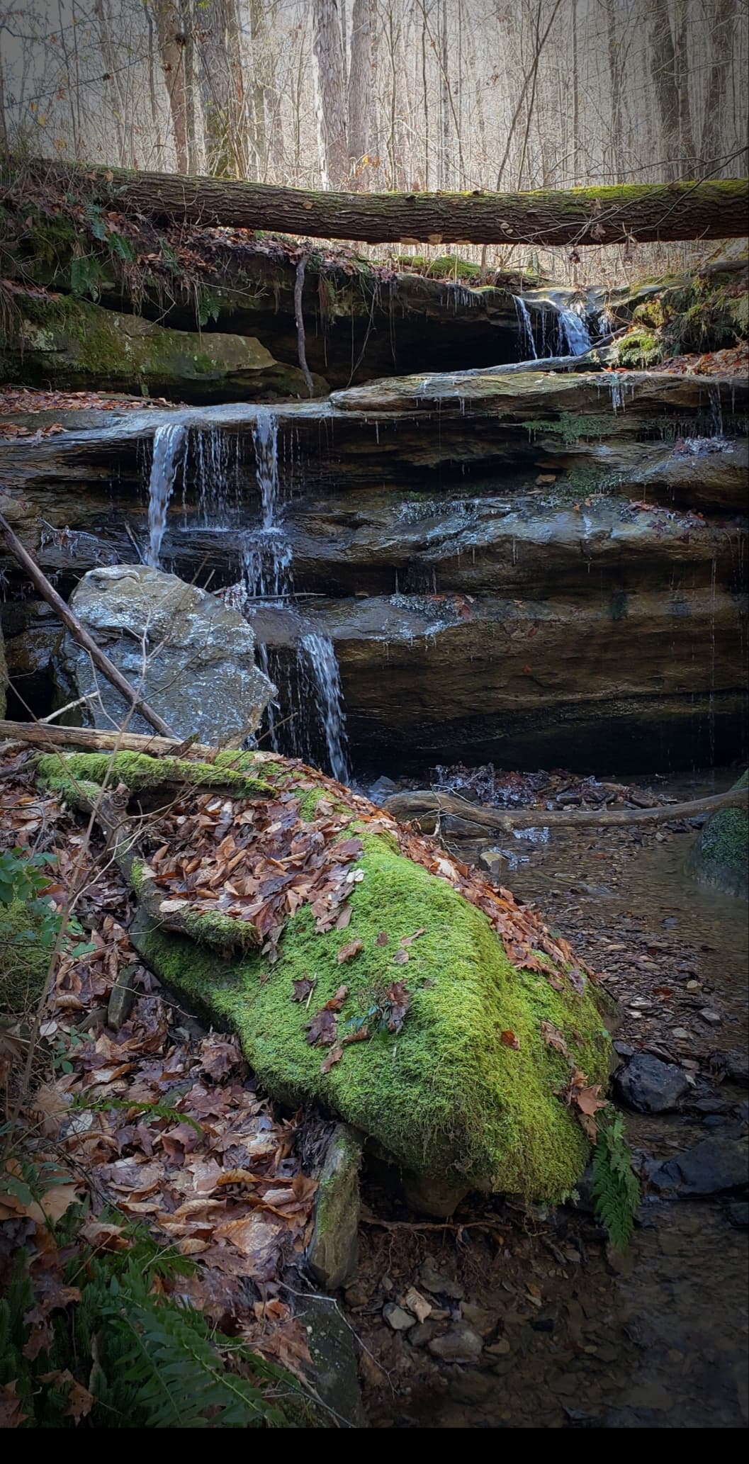
Like many of Ohio's wildlife areas, Coalton Wildlife Area consists of former coal-mining lands. It is located just northeast of Lake Katharine State Nature Preserve, but lacks the degree of spectacular gorge formation found there, because the blackhand sandstone, which forms the gorges, is only exposed in the lowest stream valleys. Nonetheless, there are still plenty of rock formations and beautiful scenery. There is also little in the way of road penetration, so that the land can be appreciated without traffic interference. To reach Coalton Wildlife Area, take OH-32 36 miles west from US-33 at Athens to US-35. Take US-35 north to the Chillicothe Pike/Rock Run Road exit. At the bottom of the exit ramp, turn left on Rock Run Road and go 0.5 mile to Sunnydale Road. Turn left on Sunnydale and go 0.2 mile to Jackson Hill Road. Turn left on Jackson Hill Road. Go 0.9 mile to Raysville Road, and turn left on Raysville. You will enter the wildlife area in another 0.8 mile. |
|